
Wakulla river
Edward Ball Wakulla Springs State Park, Wakulla Park Drive, Crawfordville, FL, USA
Add To Trip Planner Directions
Wildlife is abundant along this clear, spring-fed river lined with majestic, moss-draped cypress trees. Manatees, once seen only in summer, are now spotted year-round. Look carefully for manatee at the US 98 bridge and around an island mid-way on the river, just before the power lines. Paddlers can choose between two bridges south of Wakulla Springs State Park to access the river. The current is usually gentle enough to paddle up and back for any distance desired.
The Wakulla River is a popular paddling destination and suitable for beginners. On weekends and during the summer months the river may be crowded with powerboats and people floating in tubes. Enjoy a more serene experience by visiting on weekdays or during north Florida’s pleasant winter months. The current is generally mild enough and water levels sufficient to be able to paddle from either the CR 365 bridge or the US 98 bridge and make a round trip going upstream or downstream. It is about 4 miles distance between the two bridges, the designated trail endpoints. You may also extend your trip by paddling further downstream to the St. Marks City Park, (2.6 miles downstream from the US 98 Bridge) or further downstream to the historic fort site at San Marcos de Apalachee Historic State Park (3.2 miles from the US 98 Bridge). At this site the Wacissa River joins the St Marks River and both form an ever-widening channel to the Gulf of Mexico, bordering the unspoiled St Marks National Wildlife Refuge. From the San Marcos de Apalache Historic State Park it is also possible to continue further upstream about 5 miles on the St Marks River to the US 98 bridge and Newport County Campground.
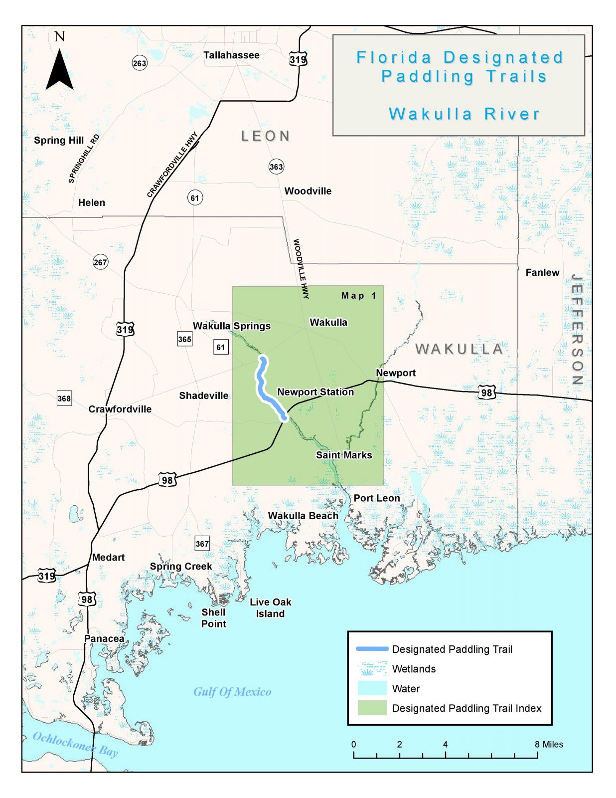
The following map and trail guide are provided courtesy of the Florida Department of Environmental Protection, Office of Greenways and Trails.
Click here for trail guide and map.
OUTFITTERS AND SHUTTLE SERVICE
DISCLAIMER: The Original Florida Tourism Task Force (dba Visit Natural North Florida) and the North Central Florida Regional Planning Council do not warrant the accuracy or timeliness of this map and paddle guide or the safety of this trail for use by paddlers. Paddler should use this trail only if they have the adequate skill level and equipment, and paddlers must make that determination. Paddlers should also check weather forecasts and water levels in advance to avoid unnecessary danger. The Original Florida Tourism Task Force, the local governments in which these bicycle routes are located and the North Central Florida Regional Planning Council are not responsible for any damages whatsoever from its use.