
Lower Ochlockonee River
4748 Crooked Road, Tallahassee, FL, USA
Add To Trip Planner Directions
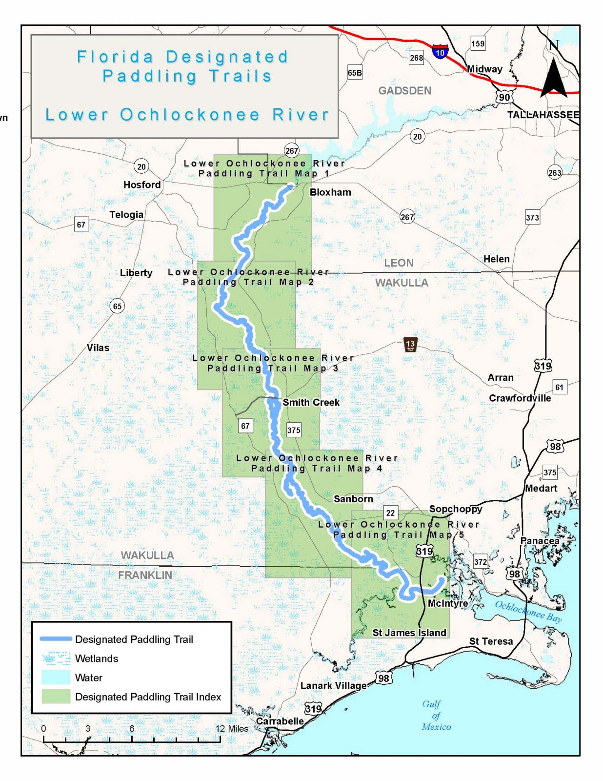
Most of this scenic river winds through the rugged wilderness of the Apalachicola National Forest and other public conservation lands, past high pine bluffs and dense hardwoods. Near Ochlockonee River State Park, the end of the trail, the river widens and motorboats are more common as the river nears Ochlockonee Bay and eventually the Gulf of Mexico. Releases from the Jackson Bluff Dam vary water levels, and downed trees and log jams may be present during low water and after storm events. Campsites, campgrounds and fish camps are numerous.
This long paddling trail is not suitable for beginners due to areas of navigational difficulty. Low water may require portaging while high water can make conditions dangerous. The river above Hitchcock Lake is more unpredictable, with numerous twists and turns. The full trip from SR 20 to Ochlockonee River State Park is about 62 miles, but paddling to some campgrounds off the river will add distance. It is important to note that there is a 12-mile stretch between Bradwell and the Arnold Ramp with no access points, so plan accordingly. Recommended minimum flow level for the Smith Creek gauge is 6.2 feet and 3.0 feet at the Bloxham gauge. Most of the access points are in very remote locations and leaving a vehicle overnight may be risky, consider contacting an outfitter for shuttling or arrange for safe parking.
The following map and trail guide are provided courtesy of the Florida Department of Environmental Protection, Office of Greenways and Trails.
Click here for trail map and guide.
OUTFITTERS AND SHUTTLE SERVICE
DISCLAIMER: The Original Florida Tourism Task Force (dba Visit Natural North Florida) and the North Central Florida Regional Planning Council do not warrant the accuracy or timeliness of this map and paddle guide or the safety of this trail for use by paddlers. Paddler should use this trail only if they have the adequate skill level and equipment, and paddlers must make that determination. Paddlers should also check weather forecasts and water levels in advance to avoid unnecessary danger. The Original Florida Tourism Task Force, the local governments in which these bicycle routes are located and the North Central Florida Regional Planning Council are not responsible for any damages whatsoever from its use.