
Aucilla River
Middle Aucilla Conservation Area, Lamont, FL, USA
Add To Trip Planner Directions
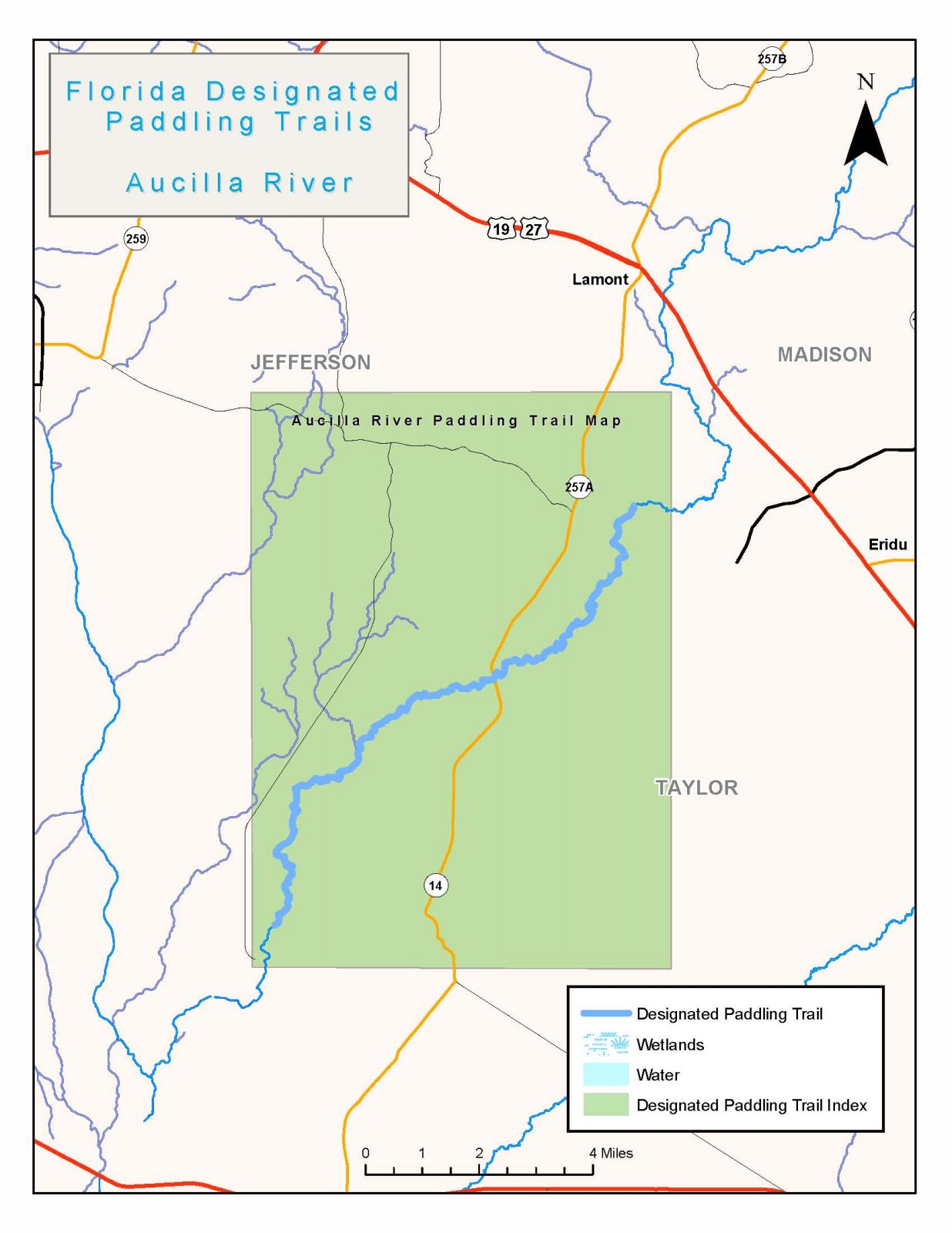
With high limestone banks and an arching canopy of live oaks, cypress and other trees, the Aucilla River is as picturesque as it is wild. he river is designated a National Recreation Trail and runs 75 miles to the Gulf of Mexico, much of it within the Aucilla Wildlife Management Area and lands managed by the Suwannee River Water Management District. Only about a third is navigable as the river plunges underground near Goose Pasture Road and reappears nearby as a chain of sink holes strewn through a lush, primal landscape. The Aucilla emerges about eight miles later at Nutall Rise and totally changes character, becoming flatter,wider and brackish as it ends with majestic vistas of the Gulf of Mexico. ike on stellar trails, paddle the historic Slave Canal in addition to nearby Wacissa River Paddling Trail and Econfina Rivers, and enjoy abundant wildlife in this photographer’s dreamscape.
The following map and trail guide are provided courtesy of the Florida Department of Environmental Protection, Office of Greenways and Trails.
Click here for trail map and guide.
OUTFITTERS AND SHUTTLE SERVICE
Wacissa River Canoe and Kayak Rentals
DISCLAIMER: The Original Florida Tourism Task Force (dba Visit Natural North Florida) and the North Central Florida Regional Planning Council do not warrant the accuracy or timeliness of this map and paddle guide or the safety of this trail for use by paddlers. Paddler should use this trail only if they have the adequate skill level and equipment, and paddlers must make that determination. Paddlers should also check weather forecasts and water levels in advance to avoid unnecessary danger. The Original Florida Tourism Task Force, the local governments in which these bicycle routes are located and the North Central Florida Regional Planning Council are not responsible for any damages whatsoever from its use.