
Goose Creek Bay
Wakulla Beach Road, Crawfordville, FL, USA
http://fdep.maps.arcgis.com/apps/MapTour/index.html?appid=e117dcb1b2e94d9cb6144717f09ff3e1
Add To Trip Planner Directions
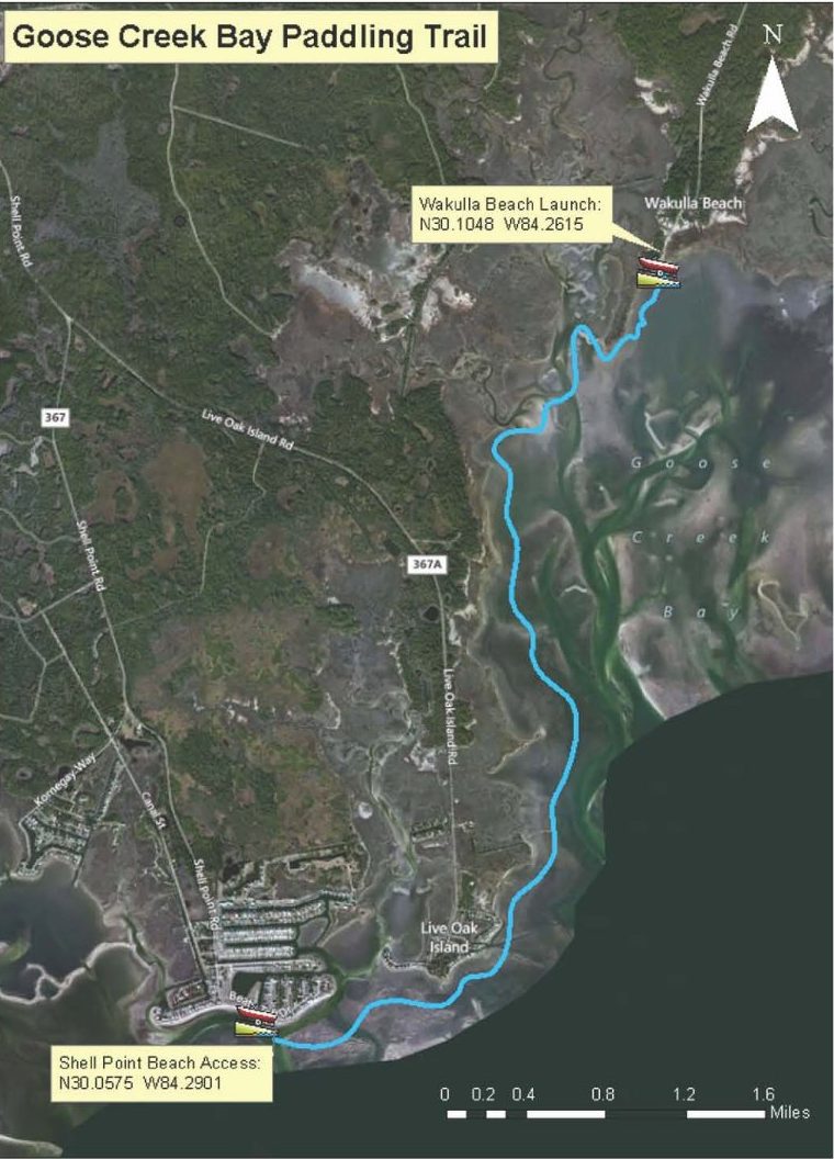
Begin at Shell Point Beach. Paddle east along the shore past Walker Creek and Live Oak Island. Follow the shoreline of the St. Marks National Wildlife Refuge to explore Goose Creek Bay and creeks. End at Wakulla Beach Boat Ramp.
Considerations: There is open water at the beginning, which can be choppy in windy conditions. Goose Creek Bay is sheltered. Best taken on an incoming tide.
Focus: Photography, birdwatching, fishing. This is a very scenic route, with many inlets such as Shepherd’s Spring, to explore.
Distance: 6 miles, 3 hours.
Put In: Continue east on US 98. Before crossing the Wakulla River, turn right (south) onto Wakulla Beach Road. This is a graded, dirt road through the St. Marks National Wildlife Refuge. The beach and boat launch is at the end of the road. There is interpretation and parking.
Take Out: Continue east on US 98. Before crossing the Wakulla River, turn right (south) onto Wakulla Beach Road. This is a graded, dirt road through the St. Marks National Wildlife Refuge. The beach and boat launch is at the end of the road. There is interpretation and parking.
Expertise: Intermediate and up. The following map and trail guide are provided courtesy of Florida Department of Environmental Protection, Florida Coastal Management Program, the Wakulla County Tourist Development Council and the Florida Department of Economic Opportunity.
Click herer for trail map and guide.
DISCLAIMER: The Original Florida Tourism Task Force (dba Visit Natural North Florida) and the North Central Florida Regional Planning Council do not warrant the accuracy or timeliness of this map and paddle guide or the safety of this trail for use by paddlers. Paddlers should use this trail only if they have the adequate skill level and equipment, and paddlers must make that determination. Paddlers should also check weather forecasts and water levels in advance to avoid unnecessary danger. The Original Florida Tourism Task Force, the local governments in which this paddling trail is located and the North Central Florida Regional Planning Council are not responsible for any damages whatsoever from its use.