
Indian Point
Wakulla Beach Road, Crawfordville, FL, USA
http://fdep.maps.arcgis.com/apps/MapTour/index.html?appid=d51d35f729f24a6482dc5223cd4c007c
Add To Trip Planner Directions
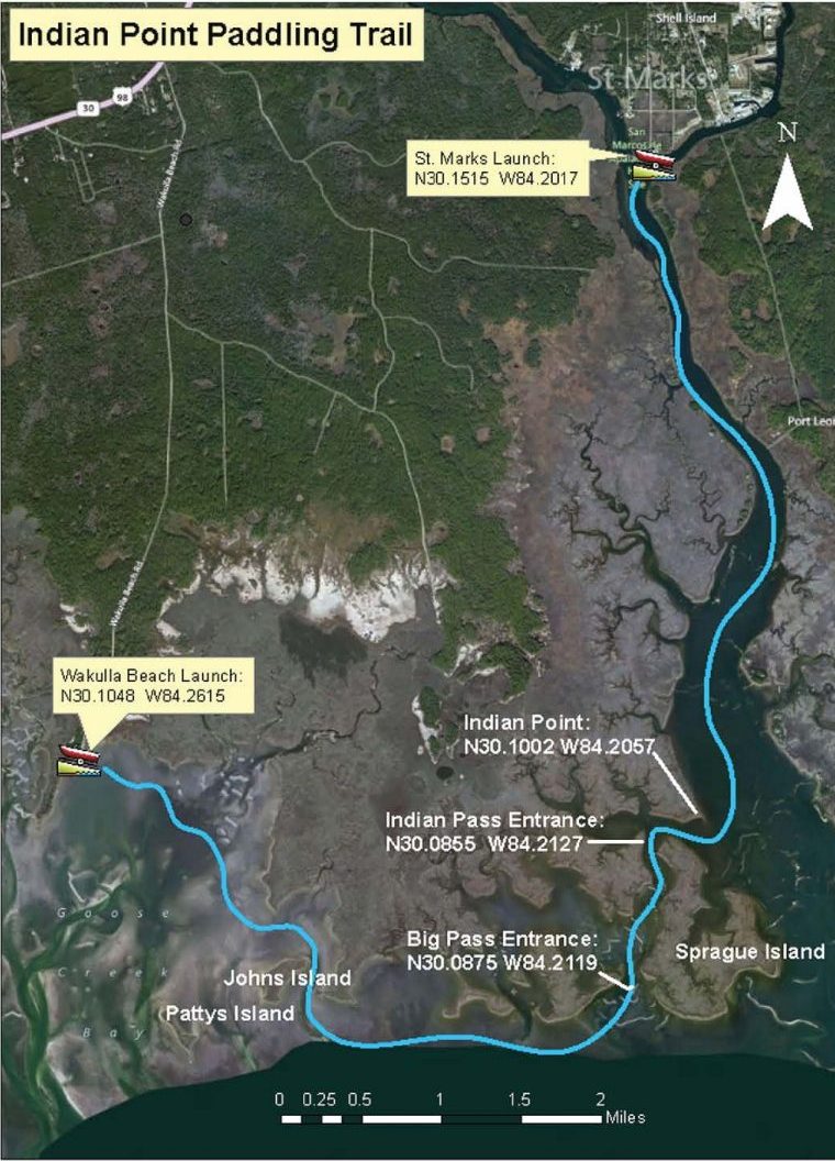
Begin at Wakulla Beach Boat Ramp. Paddle east, behind John’s Island, passing islands topped with Sabal Palms, into the protected waters of Big Pass. Enter the St. Marks River at Indian Point and continue upriver to the city of St. Marks. End at St. Marks Boat Ramp.
Considerations: This route is in protected waters, except for the short distance between John’s Island and Big Pass. It should be taken on an incoming tide, which will make the stretch up the St. Marks River much easier. Reverse the trip on an outgoing tide.
Focus: Fishing for Sea Trout and Red Fish is excellent near shore and there is ample opportunity to explore the inlets along the way.
Distance: 8.7 miles, 4.5 hours.
Put In: Continue east on US 98. Before crossing the Wakulla River, turn right (south) onto Wakulla Beach Road. This is a graded, dirt road through the St. Marks National Wildlife Refuge. The beach and boat launch is at the end of the road. There is interpretation and parking.
Take Out: From Wakulla Beach Road, continue east on US Highway 98. Turn south at the intersection with Port Leon Dr. (SR 363) to the City of St. Marks. Follow signs to San Marcos de Apalache Historical State Park, which is before the city park, with boat launch, restrooms, pavilion, trash cans, and parking. Put in on the grass next to the ramp.
Expertise: Intermediate and up.
Click here for trail map and guide.
DISCLAIMER: The Original Florida Tourism Task Force (dba Visit Natural North Florida) and the North Central Florida Regional Planning Council do not warrant the accuracy or timeliness of this map and paddle guide or the safety of this trail for use by paddlers. Paddlers should use this trail only if they have the adequate skill level and equipment, and paddlers must make that determination. Paddlers should also check weather forecasts and water levels in advance to avoid unnecessary danger. The Original Florida Tourism Task Force, the local governments in which this paddling trail is located and the North Central Florida Regional Planning Council are not responsible for any damages whatsoever from its use.