
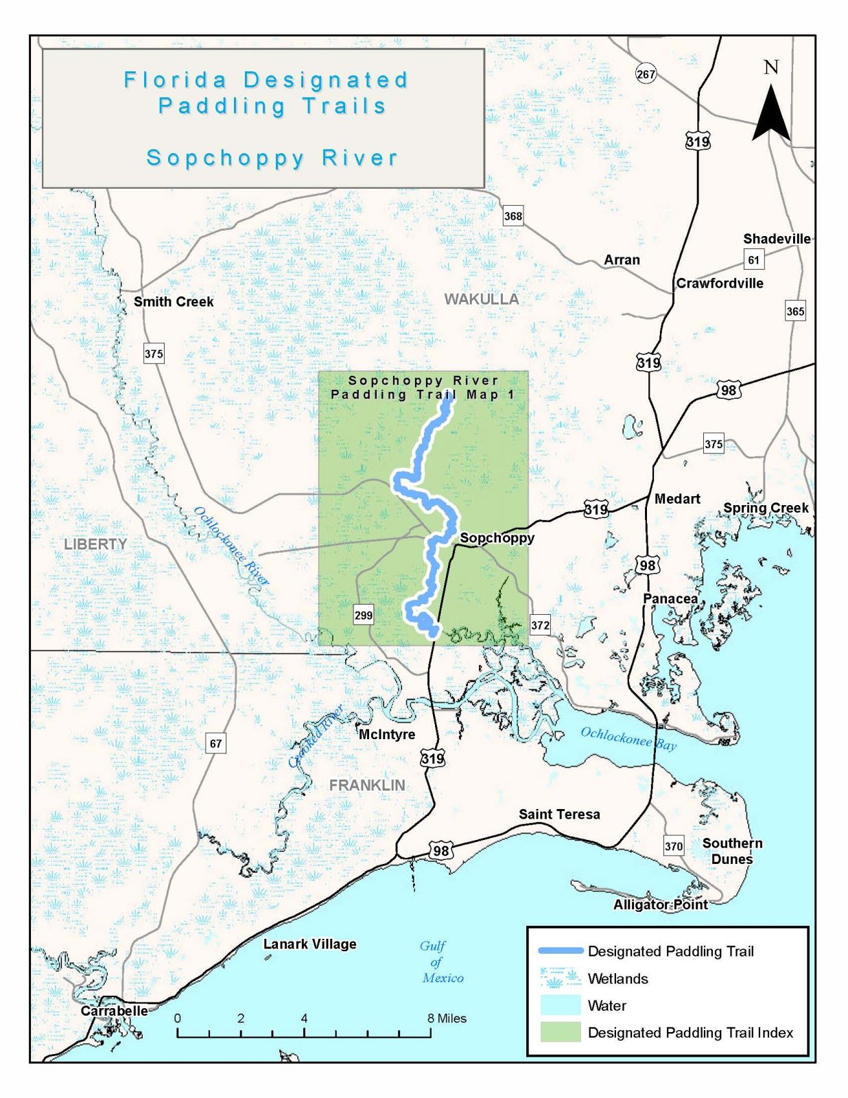
Sopchoppy River
Forest Rd 343, Sopchoppy, FL 32358, USA
Add To Trip Planner Directions
Some 50 miles in length, the Sopchoppy is a beautiful river with high, narrow limestone banks and unique cypress tree formations flowing through the Apalachicola National Forest and beyond. Numerous white sandbars make for enticing rest stops. Deer can often be seen along the shore or swimming across the tea-colored river. In spring, wild azalea and other flowering plants add color along the banks where the Florida National Scenic Trail follows portions of the river.
The following map and trail guide are provided courtesy of the Florida Department of Environmental Protection, Office of Greenways and Trails.
Click here for trail map and guide.
DISCLAIMER: The Original Florida Tourism Task Force (dba Visit Natural North Florida) and the North Central Florida Regional Planning Council do not warrant the accuracy, timeliness or safety of this map and paddle guide or the safety of this trail for use by paddlers. Paddlers should use this trail only if they have the adequate skill level and equipment, and paddlers must make that determination. Paddlers should also check weather forecasts and water levels in advance to avoid unnecessary danger. The Original Florida Tourism Task Force, the local governments in which this paddling trail is located and the North Central Florida Regional Planning Council are not responsible for any damages whatsoever from its use.