
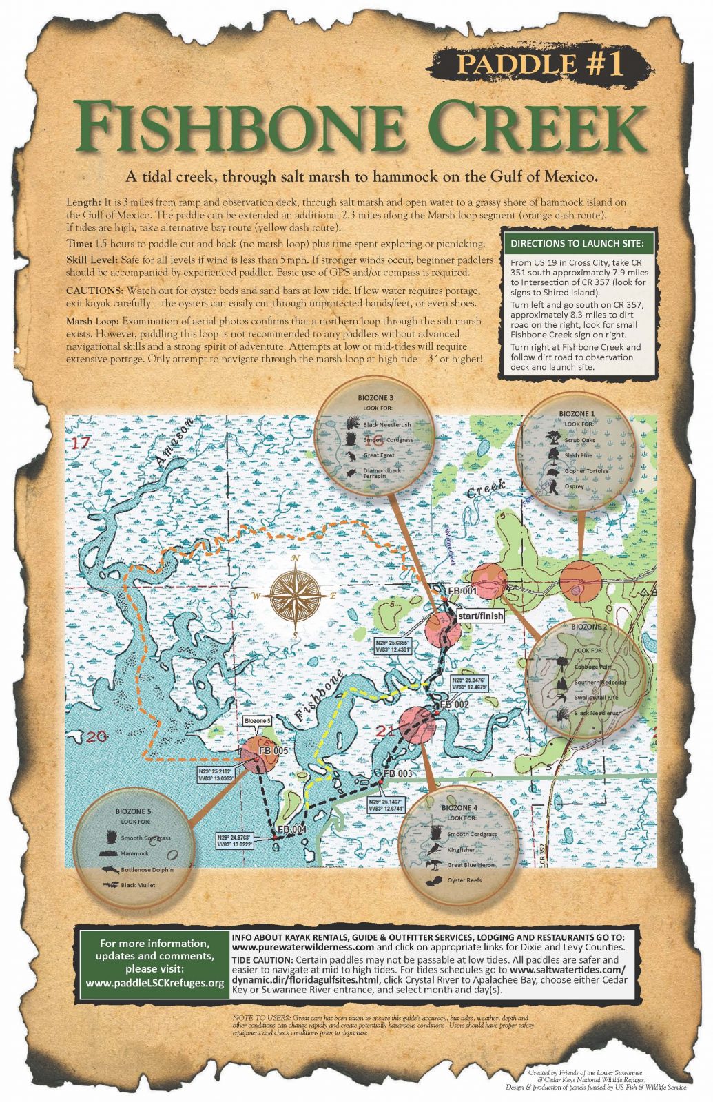
Fishbone Creek
Fishbone Creek, Florida, USA
http://www.friendsofrefuges.org/
Add To Trip Planner Directions
Fishbone Creek is a tidal creek through salt marsh to hammock on the Gulf of Mexico.
Length: It is 3 miles from ramp and observation deck, through salt marsh and open water to a grassy shore of a hammock island on the Gulf of Mexico. The paddle can be extended an additional 2.3 miles along the Marsh loop segment. If tides are high, take alternative bay route (yellow dash route). Time: 1.5 hours to paddle out and back (no marsh loop) plus time spent exploring or picnicking. Skill Level: Safe for all levels if wind is less than 5 miles per hour. If stronger winds occur, beginner paddlers should be accompanied by experienced paddler. Basic use of GPS and/or compass is required.
CAUTIONS: Watch out for oyster beds and sand bars at low tide. If low water requires portage, exit kayak carefully – the oysters can easily cut through unprotected hands/feet, or even shoes. Marsh Loop: Examination of aerial photos confirms that a northern loop through the salt marsh exists. However, paddling this loop is not recommended to any paddlers without advanced navigational skills and a strong spirit of adventure. Attempts at low or mid-tides will require extensive portage. Only attempt to navigate through the marsh loop at high tide – 3´ or higher!
The following map and trail guide are provided courtesy of Friends of the Lower Suwannee and Cedar Key National Wildlife Refuges.
Click here for trail map and guide.
DISCLAIMER: The Original Florida Tourism Task Force (dba Visit Natural North Florida) and the North Central Florida Regional Planning Council do not warrant the accuracy or timeliness of this map and paddle guide or the safety of this trail for use by paddlers. Paddlers should use this trail only if they have the adequate skill level and equipment, and paddlers must make that determination. Paddlers should also check weather forecasts and water levels in advance to avoid unnecessary danger. The Original Florida Tourism Task Force, the local governments in which this paddling trail is located and the North Central Florida Regional Planning Council are not responsible for any damages whatsoever from its use.