
Steinhatchee River
Steinhatchee Falls, Steinhatchee, FL, USA
Add To Trip Planner Directions
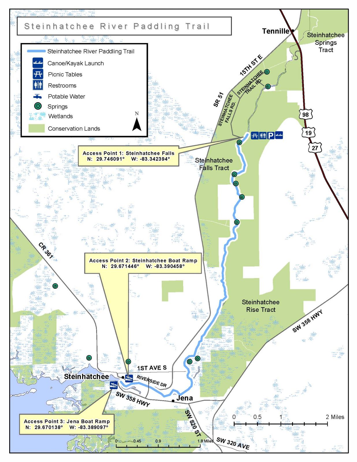
The Steinhatchee River is a serene blackwater river forming the boundary between Dixie and Taylor Counties, entering the Gulf of Mexico along the Big Bend coastline between the small towns of Jena and Steinhatchee. It begins as a shady meandering waterway just below a limestone ledge that creates the picturesque and historic Steinhatchee Falls. The upper stretches of the river are pristine and remote with no houses visible the first mile or so. The river continues to widen as it nears the Gulf, a distance of 6-7 miles depending on where paddlers choose to end a trip. The Steinhatchee River is appropriate for beginning paddlers and canoes although windy conditions and tidal effects may be encountered when the river meets the Gulf.
The following map and trail guide are provided courtesy of the Florida Department of Environmental Protection, Office of Greenways and Trails.
Click here for map and trail guide.
DISCLAIMER: The Original Florida Tourism Task Force (dba Visit Natural North Florida) and the North Central Florida Regional Planning Council do not warrant the accuracy, timeliness or safety of this map and paddle guide or the safety of this trail for use by paddlers. Paddlers should use this trail only if they have the adequate skill level and equipment, and paddlers must make that determination. Paddlers should also check weather forecasts and water levels in advance to avoid unnecessary danger. The Original Florida Tourism Task Force, the local governments in which this paddling trail is located and the North Central Florida Regional Planning Council are not responsible for any damages whatsoever from its use.