
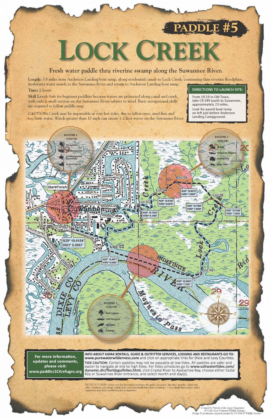
Lock Shingle Creek
Anderson Landing River Camp, Southeast 349 Highway, Suwannee, FL, USA
Add To Trip Planner Directions
A tidal creek flowing through fresh water marshes along the Suwannee River.
Length: 6.9 miles from Anderson Landing boat ramp, along residential canals to Lock Creek; continuing through riverine floodplain, freshwater water marsh to the Suwannee River and return to Anderson Landing boat ramp.
Time: 3.5 hours
Skill Level: Not recommended for beginner paddlers due to length of paddle, and navigational skills required. Waters are protected along canal and Lock and Shingle creeks, but are subject to wind and tides along the Suwannee River. Advanced navigational skills are required to follow lat/long waypoints.
CAUTION: Creek may be impassable at very low tides, due to fallen trees and mud flats. Winds stronger than 10 mph can create waves of 1-2 feet in Suwannee River and not safe for beginner paddlers.The following map and trail guide are provided courtesy of Friends of the Lower Suwannee and Cedar Key National Wildlife Refuges.
Click here for trail map and guide.
Disclaimer: The Original Florida Tourism Task Force (dba VisitNatural Nroth Florida) and the North Central Florida Regional Planning Council do not warrant the accuracy or timeliness of this map and paddle guide or the safety of this trail for use by paddlers. Paddlers should use this trail only if they have the adequate skill level and dquipment, and paddlers must make that determination. Paddlers should also check weather forecases and wter levels in advance to avoid any unnecessary danger. The Original Florida Tourism Task Force, the local governments in which this paddling trail is located and the North Central Florida Regional Planning Council are not responsible for any damages whatsoever from its use.