
Where’s The Beach?—at Horseshoe Beach!
If you’re heading to Horseshoe Beach, forget about swimming and sunbathing along sandy shores. But if you’ve got fall fishing on your mind, you’re heading in the right direction.
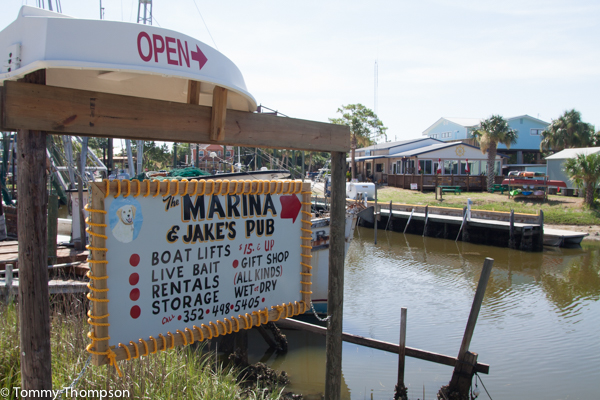
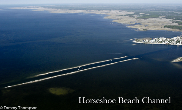
This small fishing village is located at the dead end of CR351, about 25 miles southwest of Cross City and US19/98, on a small peninsula jutting into the Gulf of Mexico between the mouth of the Suwannee River and Steinhatchee. There’s a decent public launching ramp with limited parking and a newly cleaned-out access channel to the turning basin. Horseshoe Beach Marina ((352) 498-5687 uses a 12.000 pound-capacity sling for trailer launches, but the adjacent canal can be problematic for larger boats on very low tides. It’s best to check the tide tables and call ahead before you go—the marina has variable hours. There are no motels in Horseshoe Beach, but there are several in Cross City, including The Carriage Inn ((352) 498-3910) and The El Dorado Motel ((352) 498-3307). With the exception of the Horseshoe Beach Café ((352) 498-7061), the same goes for local food. Lily Creek General Store and Café is on CR351 back towards Cross City, where you’ll find my favorite place to eat in Dixie County, The Cypress Inn Restaurant (352) 498-7211.
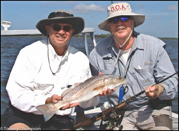
While isolated from ‘civilization’, the Horseshoe Beach area offers some of the best inshore and offshore fishing on the Big Bend. And November is certainly one of the peak months, with the Gulf waters cooling down from the long hot summer.
To the south of town, inshore anglers will find Horseshoe Cove, with its numerous oyster bars and rocky eastern shoreline. Depending on the outflow of the Suwannee River, the water here can be clear-ish to muddy, especially if there’s a southwesterly wind. That’s probably why there are oyster bars found well offshore of the shoreline and why local clam fishermen maintain clam lease areas along the front of the cove. If you consider these bars and lease boundaries obstacles to fishing Horseshoe Cove, you might head elsewhere. But if you learn the area and watch the tides, you’ll find some great angling for sea trout and redfish here. If you launch at the County Ramp, head around the point to the turning basin and then head out the main channel. If the tide’s low, you’ll need to go to marker #10 before you head slowly east towards shore. I can easily make this trip in my flats skiff when the tide level is above 1.7 feet, but I don’t run on plane. If the tide’s flooding, you can turn south at the eastern end of the rock spoil bank, work your way to the cove, and then head east. I don’t recommend anyone stay up in Horseshoe Cove much past the middle of a falling tide! In November, I’d recommend you spend your fishing time here around the bars at the mouths of Butler Creek (N29 25.842 W83 14.206), Amason Creek (N29 25.730 W83 13.498) or Fishbone Creek (N29 25.019 W83 13.045). The deeper edges of these bars will usually yield nice reds and trout for anglers tossing topwater plugs or bouncing jigs of the bottom. Take care to be stealthy, as some of the bigger fish here are spooky. I recommend using a push pole or trolling motor to approach the bars. And wading is a good option—if the water’s not too cold for your sensitive Florida legs.
The inshore fishery to the north of the County boat ramp is decidedly different from that to the south. First, the water is cleaner and clear. Second, most of the oyster bars are along the fronts of creeks and not in the middle of the bay between town and the Pepperfish Keys to the north. There are, unfortunately for many boaters, many areas of solid limestone rock scattered about the bay. Take your time, and don’t just plow through the oyster bars near the boat ramp and run northwest. Depending on the tide, inexperienced visiting anglers will do best to run out to marker #10 and run at moderate speed and high trim on a northerly course. While running, look for Spanish mackerel attacking late-season bait schools trapped by the tides by the Pepperfish Keys promontory, but set your sights on Stuart Point (N29 29.230 W83 20.640) at the mouth of Little Rocky Creek. Then, drifting or using your electric motor, head down the shoreline southeasterly to Drum Point (N29 28.476 W83 19.857), then to the rocky front of Boggy Creek (N29 28.221 W83 19.289). This is a great drift if you’ve get a northwest wind following a November cold front—and a terrific area to sight fish redfish with fly rods or free-lined artificial shrimp. Sea trout will also be plentiful, particularly on sunny afternoons when the tide’s just beginning to cover up the rocky bars.
Offshore anglers find Horseshoe Beach a good access point to the reliable 60-foot depths where cool water grouper and king mackerel tend to congregate in late fall. The 10-fathom contour comes nearer shore here than other Big Bend ports, and there are several popular spots to consider. Lamb Spring (N29 26.628 W83 50.627) is about 25 nautical miles west of Horseshoe Beach and The Crack (N29 23.819 W83 42.722) is closer to shore and slightly south of west. If you run about 25NM southwest, you’ll find the rubble from the White City Bridge (N29 10.000 W83 39.081) and often plenty of action. Depending on water temperatures, you may want to troll over, rather than bottom fish, these spots. Cooler weather means friskier offshore fish, and many can’t resist a large lipped plug passing over their heads.