
Take A Virtual Vacation to Yankeetown, Florida—A Fisherman’s Paradise
Take A Break and Take a Virtual Vacation in Natural North Florida
Spring 2020 has brought a sllowdown to Florida tourism, and tourism worldwide.. Our Visit Natural North Florida region has slowed, too, and with the restrictions of social distancing and travel we’re all dreaming of better times to come. And we hope that potential visitors, from near and far, take care of themselves, and dream of coming to visit us when the “fever” breaks. In the meantime, take some time to peruse our special “edition” of Virtual Vacations in Natural North Florida. This post is an another in that series. More, featuring highlights of our 15-county region will follow, each including links to local highlights, where “Nature Is Our Theme Park“
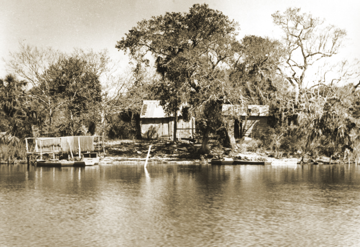
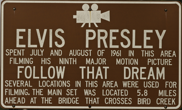
Yankeetown is located alongside the final 4 miles of the Withlacoochee River, in Levy County, It’s about 12 miles north of Crystal River, is accessed by either CR40, through Inglis, or by CR40A from the northeast. Both roads lead from US19/98. CR40 runs eastward from Inglis to Dunnellon and then on to I-75. The town was originally founded as a hideaway for visiting “Yankees”, and fishing was the main pastime. Otherwise, its main claim to fame was the filming of the (worst ever!) Elvis Presley movie, “Follow That Dream” in the early 1960’s.
A few thoughts regarding fishing at Yankeetown. More information at: http://www.saltwateranglersguide.com/
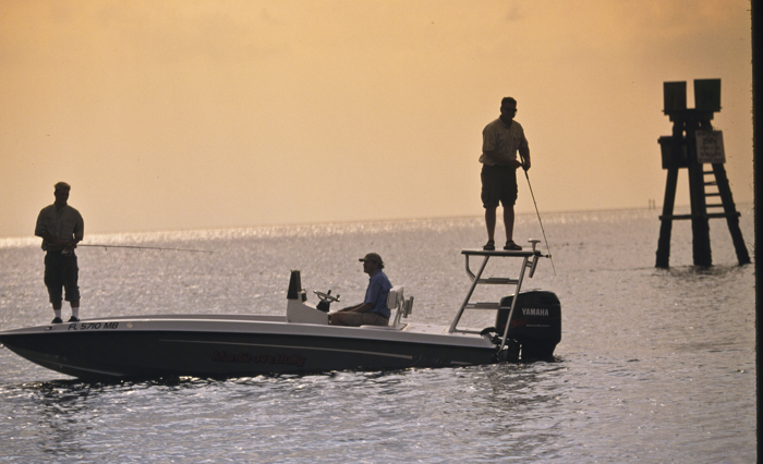
Inshore Fishing
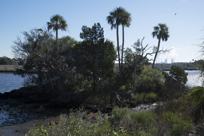
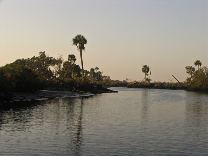
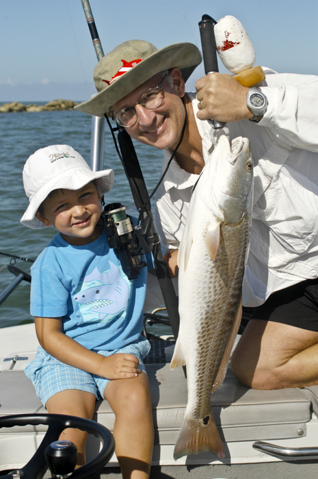
“There’s some great inshore and near shore fishing to the north of the Withlacoochee River, too. The rocky coastline, starting at the river, to Corrigan’s Reef east of Cedar Key, is treacherous, and perfect redfish habitat, during the late fall and winter. Extreme tides trap fish in deeper holes behind Porpoise Point (N29 03.370 W82 48.421), Turtle Creek Point (N29 05.950 W82 49.531) and even well into Low’s Bay. Many anglers move into these areas on high tides and stay for the entire tidal cycle, catching big reds on topwater lures or on live shrimp. Others, with kayaks, canoes, shallow-water skiffs, and airboats, have the luxury of making their own schedules.
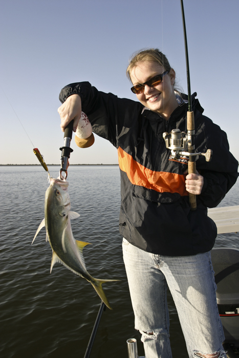
Once the spring winds ease, ‘locals’ start fishing the grass flats in Waccasassa Bay, which comprises all the water in this corner of coastline. Fed by the two rivers, numerous creeks, and bounded by the Cedar Keys on the west, the bay is a ‘catch-all’ for many species of fish. Trout are abundant on the flats, as are cruising cobia and schools of Spanish mackerel. Rocky areas are found primarily on the eastern side of the bay in 3 to 8 feet of water, while the deeper flats in the center of the bay are mostly sea grass covered. The closer you find yourself to shore, in any direction, the rockier or rougher the bottom. Small rocky creeks northwest of the Waccasassa River mouth hold fish in deeper holes, as does the Waccasassa itself. A good place to begin drifting for trout with shrimp-sweetened jigs is the ‘Trout Stake’ (N29 02.488 W82 50.405), located equidistant from the Withlacoochee ‘Bird Cage’ (N28 58.879 W82 48.445) and the end of the Waccasassa channel (N29 05.998 W82 51.716). Either of these river marks is a good place to turn directly towards the Trout Stake. Be sure to keep a big rod ready as you’ll likely see cobia, tarpon or even sharks cruising as you fish the flats, particularly if you drift northwards over the Waccasassa Reefs, near the channel.”
Offshore Fishing
“First, it’s 18 nautical miles from the ‘Bird Cage’ to the ‘Steel Tower’ (N28 58.515 W83 09.241) at the end of Seahorse Reef south of Cedar Key. From there, it’s another 20 miles to the ‘Barge’(N29 00.512 W83 31.623), a popular fishing spot in 50 feet of water. That’s a long haul. And second, the natural Withlacoochee channel joins up with the dredged Cross Florida Barge Canal channel and the Energy Complex barge channel. These two newer access points to the Gulf weren’t just dredged from sandy bottom, but from almost solid lime rock. All other things equal, I think I’d fish closer to port and spend less money on fuel. These two channels are deep enough for the sea-going barges and tugboats moving coal and sand in and out of the area. The edges are craggy and steep and the rock taken from their centers were distributed onto many areas, some as spoil islands and much as litter over the relatively flat bottom.
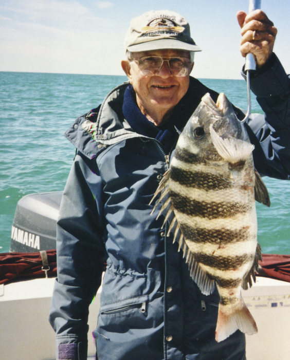
An excellent area to fish for offshore species, including grouper, cobia and king mackerel, is near the junction of the three channels. The stretch from marker #28 on the Energy Complex channel (N28 55.620 W82 51.173) to Marker #18 on the Barge Canal (N28 56.500 W82 53.251) is an excellent place to troll Mann’s Neptune STRETCH 20’s and 25’s. The 30-size lure typically used offshore just runs too deep for this area, and will hang up frequently. Troll right up against the edges of the channel, particularly on the south side, at about 4 knots. Many a commercial grouper fisherman has earned a living fishing this stretch of bottom, so give it a try. Also, don’t hesitate to check out the bottom structure outside the channel here. If you take care and mind your depth sounder while trolling, you’ll find some new bottom fishing spots and probably catch a grouper or two at the same time. Don’t neglect the areas of the Crystal River artificial reefs (approx. N28 54.900 W82 52.301) to the south, either. These older reefs can be productive for many species, and while they are fished heavily, they can be loaded with nice sheepshead in the late winter.
This channel junction area is also good for king mackerel and cobia in the warmer months. For kings, you might try trolling shallow-running lures (Yo-Zuri’s Crystal Minnow would be a good choice) a bit higher in the water column while you’re trolling near the bottom for grouper. Of course, slow-trolled live pinfish or blue runners do well, too. If you’re the first on the scene, you’ll likely find cobia cruising around many of the markers on the outer reaches of these channels. Brightly colored jigs, live white bait (caught near many of the markers), or small blue crabs are good choices for hooking up on a big cobia. The ‘long’ of this story is that the deep-water offshore spots really ‘belong’ to Cedar Key and the ‘short’ is that there’s plenty of good fishing for offshore species close to shore in the Yankeetown area. }
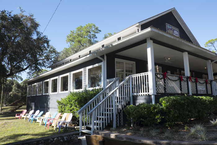
Some of the things that make Yankeetown a popular fishing destination is that are very few “things”. In fact, the center of the community is small and the historic Izaak Walton Lodge is at the center. Now operating as the Blackwater Grill and Bar, it’s the only “sit-down” eatery in the town! However, in Inglis, the community located at the intersection of CR40 and US19/98, there are several other eating opportunities, especially at Shrimp Landing Restaurant.
Of equal importance to visitors, especially those who fish, is the availability of bait, tackle, marinas and boat launches. B’s Marina and Campground, at 6621 Riverside Drive, is the largest marina in Yankeetown. Riverside Marina offers limited slips and dockage. There’s a boat launching ramp at B’s, as well as one at Yankeetown Marina, one near the USCG Station and the recently upgraded and larger one at the mouth of the river at the Gulf end of CR40.
As for fishing supplies (and local information!), be sure to stop by Captain’s Cove or Hook, Line & Sinker in Inglis. Both offer bait, ice and good honest information about the current “bite”!
Yankeetown is primarily thought of as a saltwater fishing destination, but upriver there’s some great freshwater angling. The Withlacoochee River as bisected by the (never completed) Cross Florida Barge Canal (now the Marjorie Harris Carr Greenway State Park) and it’s flow dammed, creating Lake Rousseau towards the town of Dunnellon. But….that’s fodder for another story!!!