
Apalachee Bay Maritime Heritage Paddling Trail System
If you’re a paddler, you don’t want to miss an opportunity to visit historic Wakulla County and explore the coastline.
Be transported to a different time and place as you paddle Apalachee Bay’s Ten Maritime Heritage Trails. Designed for enthusiasts of all levels, enjoy fishing, wildlife viewing, and photography as you explore one of Florida’s last great bays, its inlets, rivers, and springs. Apalachee is one of the healthiest and most productive bays in the United States, providing a host of ecosystem services to an area that lacks industrial and commercial development. Most of the Bay’s coastline is protected as part of the St. Marks National Wildlife Refuge.
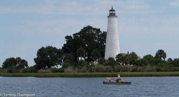
The Bay is bounded by the Ochlockonee River in the west and the Econfina River in the east. Named for the Apalachee Indian nation, Apalachee Bay is in the northeastern Gulf of Mexico, occupying an indentation of the Florida coast known as the Big Bend region. It occupies a 412 km2 surface area with an 11,900 km2 drainage area. It is surprisingly shallow, with an average depth of 3.0m. Most trails occur in Wakulla County, between the Waterfront Florida Communities of Panacea in the west and St. Marks in the east and can be completed in 2-3 hours.
For complete information, CLICK HERE
2 comments on “Apalachee Bay Maritime Heritage Paddling Trail System”
What happened? This used to show the overview (still available and kinda useful) but a more detailed map of each trail, complete with the put-in and take-outs and tide and etc info, which was REALLY helpful. Where are those maps? This went from a great resource to a huge disappointment.
Patrick…let me check on this. I’ll let you know when I have an answer as to why the link isn’t active any more!