
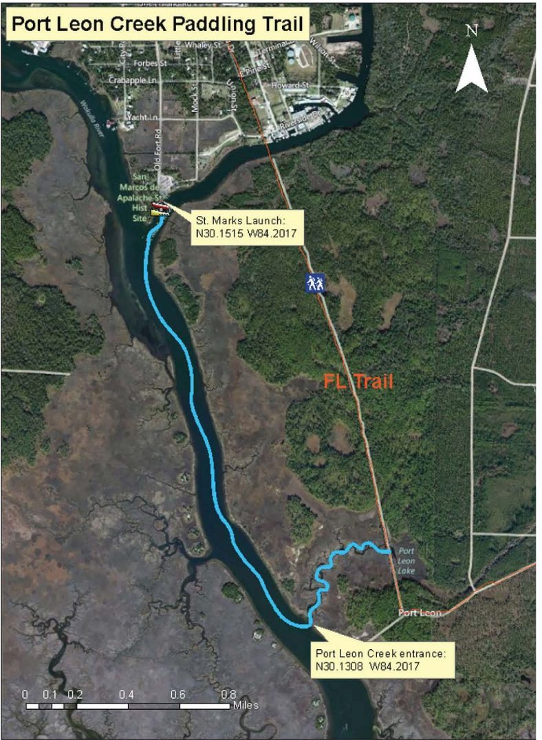
Port Leon Loop
San Marcos De Apalache Historic State Park, Florida, USA
http://fdep.maps.arcgis.com/apps/MapTour/index.html?appid=d5c094376040408fa972d77f343ead08
Add To Trip Planner Directions
Overview: Begin at the St. Marks Riverfront Park and Boat Ramp. Paddle downstream following the left (east) bank of the river to access Port Leon Creek. Explore this beautiful winding course to the old town of Port Leon. The trail ends where the train trestle spanned the creek, evidenced now by a few remaining trestle ties. Return back to the St. Marks City Boat Ramp to complete the loop trail.
Considerations: It would be best to begin the trip on an outgoing tide and return on an incoming tide.
Focus: Wildlife viewing. Paddlers will encounter Alligators perched on mashed-down reed beds along the winding creek.
Distance: 3.6 miles, 2 hours. It is 1.5 miles from the launch to Port Leon Creek. One can paddle about .3 mile upstream before the trail ends at the old train trestle.
Put In/Take Out: St. Marks Riverfront Park and Launch. From US Highway 98, turn south at the intersection with Port Leon Dr. (SR 363) toward the City of St. Marks. Follow signs to San Marcos de Apalache Historical State Park, which is adjacent to the park with restrooms, pavilions, trash cans, and parking. Put in at the grassy area next to the boat ramp.
Expertise: Beginner and up.
Click here for trail map and guide.
DISCLAIMER: The Original Florida Tourism Task Force (dba Visit Natural North Florida) and the North Central Florida Regional Planning Council do not warrant the accuracy or timeliness of this map and paddle guide or the safety of this trail for use by paddlers. Paddlers should use this trail only if they have the adequate skill level and equipment, and paddlers must make that determination. Paddlers should also check weather forecasts and water levels in advance to avoid unnecessary danger. The Original Florida Tourism Task Force, the local governments in which this paddling trail is located and the North Central Florida Regional Planning Council are not responsible for any damages whatsoever from its use.